Decoding a future of fire with AI
Climate change and decades of forest mismanagement are fueling increasingly destructive wildfires in the Western US. Scientists, lawmakers, fire chiefs and startups are all trying to gain a better understanding of the growing challenge ahead, and what role technology might play in helping us more safely manage it. In this second of a two-part series, we examine the tools and technologies being used to fight wildfires.
We Meet:
- Tricia Small, Television Producer, Small Fox Films
- George Whitesides, Space Executive
- Brittany Zajic, Disaster Response, Planet Labs
- Dave Winnacker, Fire Chief, Moraga-Orinda Fire District
Sounds from:
- California declares state of emergency; entire city of Malibu evacuated, via YouTube.
- Increase in illegal drone flights causes grounded flights, issues for firefighters, via YouTube.
Credits:
This episode was reported and produced by Jennifer Strong, Anthony Green and Emma Cillekens. It was edited by Mat Honan and contains original music from Garret Lang and Jacob Gorski. Our mix engineer is Garret Lang and our artwork is by Stephanie Arnett.
Full transcript:
[TR ID]
News Anchor 1: “We begin with that breaking news, a state of emergency in California as deadly fires explode across the state.”
News Anchor 2: “In southern California two major fires forcing the mandatory evacuation of more than 200,000 people including the entire city of Malibu.”
News Anchor 3: “This is a multimillion dollar home south of Calabasas… where we are right now… in fact this entire neighborhood has been obliterated… all the mountains across here are scorched and not a firefighter in sight… that's how stretched across southern california this morning.”
Tricia Small: It was November 8th, 2018. I heard the news report that there was a fire that was starting over the hill, about 15 minutes, and it was by the 101 Freeway. And this was about one-two in the morning.
Jennifer: Tricia Small is a television producer in Malibu, California.
Tricia Small: And about 5:36 AM they made the call to evacuate Malibu, which, uh, that had never been done in the 18 or so years that I lived here. Even though we always say, Oh, we're, you know, someone will knock on our door if there's a fire. It, it ended up being that that didn't really happen.
Jennifer: Four years ago the Woolsey Fire was one of several very large fires tearing through California all at once. It, plus the nearby Hill Fire, forced the evacuations of a quarter million people along the Pacific Coast near Los Angeles.
Tricia Small: We didn't have a good emergency system in place at all, and we lost over 700 homes, which was, you know, a population of just under 12,000 at that point. That's a lot of homes. Where I am… and, and further north of here, the flames went all the way to the water. Like we had, we, there were horses, llamas, pigs on the beach. Everybody just had to go to the edge of the, the, the sand. That's how bad it got. So something, an early warning, early detection, artificial intelligence would have alerted us and helped our evacuation to be much faster. I think.
Tricia Small: I don't think in the minute or the days or the months after, you realize the deeply embedded trauma <laugh> to your, to your soul. I think you're never quite the same. I did not lose my home, but no less than 20 of my dear friends lost everything and watching them, it's unreal. You're in shock for, for several years. It really took me a couple years to be like, Wow, our town burned down. That's nuts. Now I think we realize, oh, this can happen and this will happen again. <laugh>, I'm looking in the backyard right now. The wind is blowing. It kicks up this time of day. We humans are resilient, so we're willing to accept that possibility to live amongst such beauty. But it's a very sobering reality.
[music transition]
George Whitesides: What if I told you that we knew that there was gonna be a threat to the United States that was gonna cost tens of billions of dollars a year and hundreds of lives?
Jennifer: That’s space executive and former NASA chief of staff, George Whitesides.
George Whitesides: And we are not in a posture that is appropriate for that threat. You know, we are spending billions of dollars on certain other threat reduction programs with much less than a hundred percent certainty, but we have a hundred percent certainty that we're gonna be having these huge fires every year into the future.
Jennifer: We’re at a congressional briefing on Capitol Hill… about wildfire technologies.
George Whitesides: You know if you don't get on top of these fires really quickly in the bad conditions, you know, it could become essentially impossible for humans to stop.
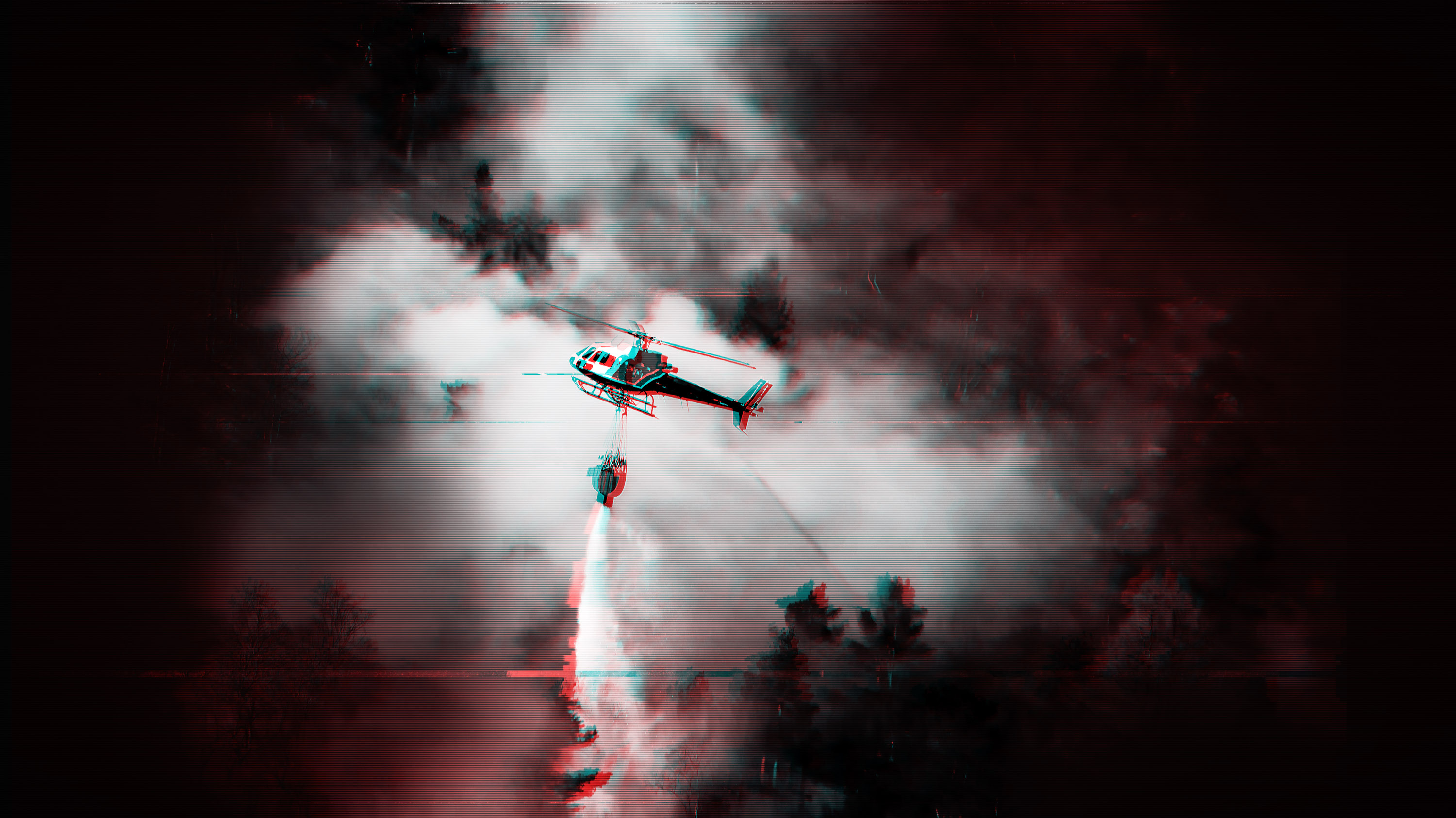
Jennifer: Fire is a force of nature… especially when it gets going at scale… which in dry and windy conditions can quickly turn into something that we can’t fight alone. Drones are the most common firefighting tech… and we’re experimenting with using them for all sorts of things… but federal agencies have a really complicated relationship with these aircraft.
News Anchor: “And drones are creating issues for Cal Fire. The Lake Fire in San Bernadino in 2015, the Maria Fire in Ventura County in 2019 and most recently the Dixie Fire. All of them had days where aerial fire crews were grounded because of drones flying in restricted airspace.”
[music]
Jennifer: Scientists, lawmakers, fire chiefs and startups are all trying to gain a better understanding of the challenge ahead… and what role technology might play in helping us more safely manage it. I’m Jennifer Strong and in this second of a two-part series, we’ll take a closer look at the tools and technologies being used to fight wildfires.
[TITLES]
Jennifer: Wildfires in the Western U-S are getting worse… growing larger, spreading faster, and reaching higher. Mountain elevations that were historically too wet and cool to support fires… are now seeing their landscapes ignite.
It’s also the case in southwest China’s largest city, Chongqing, where, in late August, wildfires ripped through the mountainous forests… surrounding the city’s 31-million residents.
The fast-moving fire was triggered by record heat and drought… and it was fought with support from a swarm of drones.
Near the ground, delivery drones carried food and supplies to firefighters… while surveillance drones flew into the thick of the flames… monitoring the fire’s path… and delivering crucial data to firefighters.
Miles above the fire, larger drone models ignited bars of silver iodide to trigger artificial rain.
China is the world leader in drone technology, and home to the world’s largest drone maker, D-J-I. But it’s a different story in the U-S, where regulators are concerned their drones could collect data… and send it back to China.
D-J-I’s drones have been grounded by several federal agencies—taking hundreds of drones used to fight fires out of U-S skies. And in recent weeks, the company was formally blacklisted by the Department of Defense after its drones were used in Ukraine by Russia.
American manufacturers and researchers are developing devices that collect real-time fire data…and can ignite controlled burns for forest health.
We also increasingly rely on satellite data.
And the leader in that space is a private company called Planet Labs. It has hundreds of small satellites that capture the entire surface of the Earth each and every day.
Brittany Zajic: So Planet Imagery is providing a daily high resolution look of what's going on on the ground that day.
Jennifer: Brittany Zajic leads disaster response for Planet Labs.
Brittany Zajic: This daily insight can allow firefighters in the event of an active wildfire to see what's going on. Understanding smoke plumes, understanding the general direction of the fire. More broadly, these fire departments have used it for updated evacuation maps to derive moisture index or vegetation health all these things that are being fed into the knowing and understanding of a type of wildfire or active event.
Jennifer: Monitoring vegetation is important because drought and high heat can kill trees and dry out dead material on the forest floor… Leading to a kindling effect when a fire sweeps through. These conditions have been made worse by fire-suppression policies dating back a hundred years… Leading to more brush… and increasingly dense forests.
Brittany Zajic: We also have fuel loads mapping, which is understanding the volumetric mass of vegetation and forest in certain areas and how that may contribute to overall wildfire risk management as a whole. And those largely get fed into big wildfire risk modeling algorithms.
Jennifer: Planet Labs also helped organize that briefing about wildfire tech on Capitol Hill.
George Whitesides: I Honestly think that we could be doing dramatically more with space technology to help our nation's wildfire problem. And more to the point, I think we could pre providing our frontline firefighters and citizens with much better data than exists today. My name is George Whitesides. I used to be the chief of staff of NASA and then I ran a space company for about 10 years, and now I'm focused on trying to help our nation's wildfire problem.
Jennifer: The space company he’s referring to is Virgin Galactic… a space tourism company owned by the billionaire Richard Branson.
George Whitesides: And we could do better. Like we could do dramatically better. As a country, we know how to do this, whether it's private industry or government, we have the technology to be providing much higher refresh rates of data at a relatively affordable cost. And I think it's frankly crazy that we are not doing that in 2022.
Jennifer: Real time data is hard for most fire departments to come by.
Dave Winnacker: Which means we need more data. We need reliable data. We need verifiable data, and we need it at scale.
Jennifer: This is Dave Winnacker. He’s the fire chief of a district outside San Francisco that’s home to some of the most destructive fires in California history, like the 1923 Berkeley Hills Fire. Right now, he says our understanding of a fire’s perimeter is based on infrared mapping that happens overnight from airplanes.
The data is sent to Denver where it gets processed… then fire response teams receive it the next morning. And he says when they get it the data will have dead spots… where a plane banks too hard and the mapping goes out of resolution… so sometimes you just won’t know what’s happening in certain parts of the fire until the next day.
Dave Winnacker: It's hard to fight fire when you're in that scenario. It's even harder to manage the forest or manage the landscape to fire, manage the pathways when you don't have a clear, accurate, verifiable, and regularly updated understanding.
Jennifer: What he’s trying to avoid is a fire coming out of a wilderness area and spreading through a community, turning buildings into sources of fuel. When it happens it’s called conflagration.
Dave Winnacker: Fire doesn't spread as a blob. It makes runs along specific pathways where weather, terrain, and fuel come into alignment. And when fire makes those runs along a pathway, that's where it exceeds suppression capabilities and it overwhelms a community's ability to quote unquote, fight the fire.
Jennifer: It’s not just the size of a fire that makes it so destructive… it’s that transition from burning plants to burning buildings. All that wood and plastic can provide a tremendous amount of fuel for a fire.
And this is where he’s starting to use A-I… to know what properties pose a risk… and what needs to be done to minimize it within his district.
Dave Winnacker: So this is an example of ground based data collection using AI to categorize risks on a parcel. There we see the route walked around the structure. And we see the presence or absence of conditions that would cause a fire to burn. This home is generally fire adapted, but for the vegetation and immediate proximity to the home, that will overwhelm all other elements of the defensible space and the home hardening that are in place. This is the type of work that needs to be done parcel by parcel with an annual refresh. But as I'm sure we can all imagine, this is incredibly labor intensive and laborious and time consuming, and it only reaches out about 30 feet from the home.
Jennifer: It’s why he needs ground-based data stitched together with remote sensing… to really understand what areas are ready for fire season… and what path potential fires might follow.
Dave Winnacker: As we move down to the bottom left here, this fire gets into a series of mobile home parks, at which point to put it as boldly as I can, all hell breaks loose. You cannot mitigate a trailer park. Fire spreads massively. It moves at speed, which is hard to fathom, and it causes enormous amounts of disruption of lives, potentially loss of life, and destroying communities.
Jennifer: And then there’s the issue of fires that happen outside his jurisdiction.
Dave Winnacker: As the fire chief, I can only control the 42 square miles of my fire district. The fire that is going to impact my fire district is going to be someone else's fire. It is going to have emanated out of different lands over which I have no jurisdiction and I have no mandate to create a data set, a platform, access for someone else's land.
Jennifer: He simply doesn’t have the ability at the local level to build systems of the size and scale that’s needed to deal with this problem. It’s why he says it’s so important the government get involved.. and help some of this tech come from the top down.
Dave Winnacker: And as a result of that, we end up with a patchwork of not only, uh, response plans and systems, but more importantly, I think preparation and mitigation plans that are built on a different premise because everyone's using someone else's proprietary lens to view the problem. And so we end up on fires and other scenarios, and particularly in the pre-fire space with a bunch of just different systems fighting for space and attention. And that is not helpful. And that's where I think having some thoughtful government role to identify the standards identify the interoperability requirements and to seed that field to bring us all these innovative things but to bring 'em in a way where they work together and we're not leaving each jurisdiction to make independent decisions about how they're going to gain access to data.
Jennifer: At this briefing fire chief Dave Winnacker and space executive George Whitesides don’t agree on everything… But they do agree on that.
George Whitesides: There is an incredibly fractionated landscape when it comes to who's dealing with fire. I like to say if the president wants to talk to somebody about wildfire, who do they call? Who does he or she call? And there isn't like a single answer to that question, which I think is a big problem for our country. But the other part of that fractionated landscape is that there are very few pots of money to build new tools for our firefighters. And there are very few big pots of money and we need that for the scale of the problem.
Jennifer: And he believes those pots of money should be more on the scale of what the government spends on hurricane science and technology.
You can find links to our reporting in the show notes... and you can support our journalism by going to tech review dot com slash subscribe.
We’ll be back… right after this.
[MIDROLL]
Arvind Satyam: Every large fire starts as a small fire. So the faster you can detect it, the faster you can help authorities confirm and understand where it's located and what it's doing that can dramatically change the landscape in terms of response.
Arvind Satyam: I'm Arvind Satyam. I'm the chief commercial officer at Pano and part of the founding team.
Jennifer: It’s a company using A-I to hunt for wildfires… via smoke detection algorithms and high definition cameras that we heard about in the last episode.
Arvind Satyam: This is an image of one of our units that's deployed in Sonoma county.
Jennifer: These cameras are currently deployed in ski towns and other high value areas in California, Idaho, Colorado and where we visited earlier, in Montana.
The cameras rotate… making a full circle about once a minute.
Arvind Satyam: As it is continuously rotating we’ve got that visual intelligence—That continuously updated panorama. We're running the smoke detection algorithm, and then we've got an intelligence center that's 24-7, and they're validating is that smoke from, uh, an actual fire or is that actually a farmer going with a tractor going down a hill and that's a dust cloud. And so we can learn a lot more by just going through that. And our analysts have tools where they can leverage powerful zoom to really understand that. And then we have an interface that allows different stakeholders. So if you're a fire authority and as I pull into it, you'll see, you'll be able to understand where is the incident. Look at satellites, look, understand vegetation, and other elements. If you're a utility, really understand the risk relative to the utility assets, speed up that part of it. Uh, and we're working on things for private landowners, insurance, and others.
Jennifer: They train their systems on historical datasets and on data they collect on the ground in the US… and in Australia.
But detecting smoke is not as straightforward as it sounds… especially when there’s fog… or smoke in the air from other fires nearby.
Arvind Satyam: And what is really looking for is texture, movement, and gradient. And so this here, what you saw was a quick spec of that smoke and the AI was able to compare it with all of the labeled images that we've got and said, yes, that is smoke. And what, what you're seeing here is a little bit of the behind the scenes, where it's really looking for validation and a confidence level.
Jennifer: And they’ve also run into some interesting challenges in ski towns… where there can be both snow and smoke at the same time.
Arvind Satyam: We were getting into the winter months. We were getting into October and November and there was snow and there was smoke. We started to train the model to understand the nuances and then we also had a whole bunch of amusing case studies where in November they started making snow. And then for the AI it's, it's like, Hey, that could be smoke, and then we quickly realized, well, that's actually where the ski runs are.
Jennifer: It’s one reason why it’s important to have humans in the loop, guiding these systems and verifying the results.
Arvind Satyam: Cameras give you that ground truth. But our intelligence center is pulling in satellites. We're also listening to urban alerts and pulse point and web, and Twitter and other things, because the more you learn about an incident, the more data points that you have that connect and say that is one that's problematic, the better it's gonna be.
Jennifer: This episode was reported and produced by me, Anthony Green and Emma Cillekens. It was edited by Mat Honan and mixed by Garret Lang… with original music from Garret Lang and Jacob Gorski.
If you have an idea for a story or something you’d like to hear, please drop a note to podcasts at technology review dot com.
Thanks for listening… I’m Jennifer Strong.
[TR ID]
Deep Dive
Artificial intelligence
Large language models can do jaw-dropping things. But nobody knows exactly why.
And that's a problem. Figuring it out is one of the biggest scientific puzzles of our time and a crucial step towards controlling more powerful future models.
Google DeepMind’s new generative model makes Super Mario–like games from scratch
Genie learns how to control games by watching hours and hours of video. It could help train next-gen robots too.
What’s next for generative video
OpenAI's Sora has raised the bar for AI moviemaking. Here are four things to bear in mind as we wrap our heads around what's coming.
Stay connected
Get the latest updates from
MIT Technology Review
Discover special offers, top stories, upcoming events, and more.