As Hurricane Earl barrels toward the eastern seaboard of the United States, coastal residents don’t know if they should evacuate in case the storm makes landfall. They rely on forecasters analyzing computer models, but those predictions differ. A new hurricane-monitoring mission that’s now underway hopes to reduce this uncertainty by gathering atmospheric and environmental storm data never before obtained.
NASA, the National Oceanic and Atmospheric Administration (NOAA), and the National Science Foundation (NSF) are conducting the largest tropical storm and hurricane monitoring mission to date. The mission involves simultaneously flying up to seven aircraft, each equipped with sophisticated instrumentation, to gather data from the time of a storm’s inception to its dissipation.
Advertisement
“There is a lot about storms that we don’t know–why does a storm rapidly intensify? How do things like aerosols, atmospheric moisture, and ocean currents affect a storm’s development?” says Gerry Heymsfield, a NASA mission scientist. “The new measurements we are making will significantly enhance our understanding and ultimately improve forecast models.”
This story is only available to subscribers.
Don’t settle for half the story.
Get paywall-free access to technology news for the here and now.
The collaborative hurricane monitoring project includes three different missions: NASA’s Genesis and Rapid Intensification Processes experiment, which will focus on how tropical storms form and develop into hurricanes; NOAA’s Intensity Forecasting Experiment, designed to better understand and predict intensity changes in storms like Hurricane Earl; and NSF’s Pre-Depression Investigation of Cloud Systems in the Tropics project, which will look at the beginning stages of a storm. The missions began in late August and will continue to the end of September. Hurricane Earl, says Heymsfield, will be one of the first storms to produce enough data to yield compelling results.
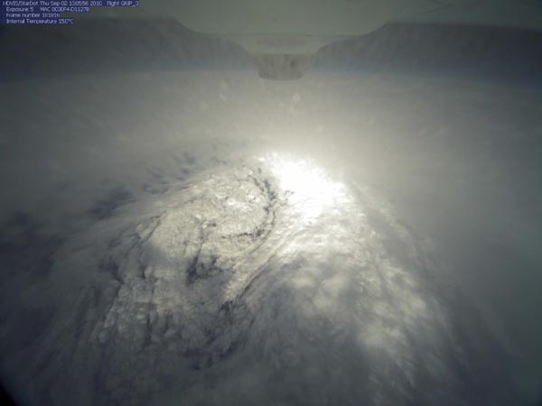
On Monday, NASA’s DC-8 aircraft and NOAA’s two jet planes flew through Hurricane Earl as it passed through the Caribbean. Although most of the information gathered will take years to analyze, the aircraft do obtain some real-time data using dropsondes, which are balloons dropped into the storm. The dropsondes measure the storm’s temperature, humidity, and pressure. The information provides a profile of the hurricane that can be assimilated into mathematical models for forecasting its track and intensity. Other instrumentation on the planes measure such things as precipitation rate, cloud distribution, winds, water content, and particle profiles.
Michael Black, a research meteorologist in the Hurricane Research Division at NOAA, says the biggest impact of the project should come from NASA’s Global Hawk, an unmanned aircraft carrying new scientific instrumentation. Unlike manned aircraft, the Global Hawk can fly for up to 30 hours and at high altitudes; it can also gather more detailed data than a satellite and can be stationed to monitor an area for extended periods. (Technology Review wrote about the robotic plane’s capabilities here.)
“The Global Hawk can sit above the hurricane and peer into it to gather the information we don’t have about the top of the storm,” Black says. At the top of the hurricane, wind flow is reversed, so instead of spiraling in from the center, the winds spiral out. A balance of wind flow between the top and bottom of a storm is what enables it to intensify from a cyclone–a closed area of rapid wind circulation–to a hurricane.
The Global Hawk took off from Edwards Air Force Base in California on Wednesday evening to make its first flight over Hurricane Earl and monitor the storm for 24 hours.
The Global Hawk payload includes two new instruments developed by NASA, one to gather horizontal wind vectors and ocean surface winds, and a second to measure and create a 3-D distribution of temperature, water vapor, and cloud liquid water. (A third new NASA instrument that measures strong ocean surface winds through heavy rain will be onboard the WB-57 aircraft, also being flown by NASA.) These three instruments are more sophisticated and will provide better measurements than anything now used, says Heymsfield.
T.N. Krishnamurti, a professor of meteorology at Florida State University, says the new hurricane monitoring mission is unique and will help researchers build more accurate models of future storms. Having a better handle on the track and intensity of storms can help emergency management groups better prepare. “So many things happen in a hurricane that are complex–a warm core forms, high wind speeds, rain bands, and ocean currents are rampant–and we have lacked observation of all these things together,” says Krishnamurti.