Balloons Put a Social Spin on Aerial Surveillance
It used to be that only satellites, drones, and airplanes could spy on you from above. Now balloon mapping is turning aerial surveillance into a remarkably cheap civilian experience.
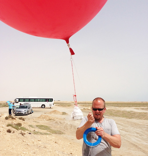
Using a hoop winder and a set of rubber bands and carabiners, would-be balloon mappers can build their own device for cheap. (If a balloon isn’t on hand, kites or small helium-filled blimps will also suffice.) An ordinary camera or smartphone, set to continuous shutter mode, is sent aloft. Later, the pictures can then be sewn together using open-source software like MapKnitter.
Kits are available online for about $100 from the Public Laboratory of Open Technology and Science (PLOTS), an open-source community focused on environmental issues. One of PLOTS’s first major mapping projects tracked the progress of the Deepwater Horizon oil spill on the Gulf Coast. Since then, PLOTS members have teamed up to produce maps of many other environmental hazards, including sewage flows in New York City’s Gowanus Canal and incinerator landfills in Saugus. Last week, the group’s Somerville chapter paired with the U.S. Fish and Wildlife Service to investigate the spread of an invasive species in a Massachusetts lake.
The data created with PLOTS’s kits is freely available online. Their website archives balloon maps from all over the world, along with spaces where members can discuss and critique each other’s work. Some maps are even used to contest official records.
“Maps are often used by those in power to exert influence over territory,” reads the introductory guide on the PLOTS website. “’Grassroots mapping’ attempts to invert this dynamic.’”
Balloon-mapping is one in an emerging group of projects that put aerial photography in the hands of ordinary people. Another, Dronestagram, invites drone hobbyists to share their best aerial shots; the site’s most-liked photos include stunning views of Dubai and the French countryside. Another online community, DIY Drones, offers guides and forums for people interested in building their own Arduino-based device.
For more info, see our breakdown of how balloon-based space photography works (“How to Photograph the Earth”).
Keep Reading
Most Popular
Large language models can do jaw-dropping things. But nobody knows exactly why.
And that's a problem. Figuring it out is one of the biggest scientific puzzles of our time and a crucial step towards controlling more powerful future models.
How scientists traced a mysterious covid case back to six toilets
When wastewater surveillance turns into a hunt for a single infected individual, the ethics get tricky.
The problem with plug-in hybrids? Their drivers.
Plug-in hybrids are often sold as a transition to EVs, but new data from Europe shows we’re still underestimating the emissions they produce.
Google DeepMind’s new generative model makes Super Mario–like games from scratch
Genie learns how to control games by watching hours and hours of video. It could help train next-gen robots too.
Stay connected
Get the latest updates from
MIT Technology Review
Discover special offers, top stories, upcoming events, and more.