The woman who brought us the world
A half-century ago, Virginia Tower Norwood ’47 invented the first multispectral scanner to image Earth from space. Landsat 1 and its successors have been scanning the planet continuously ever since.
Had Virginia Tower Norwood listened to her high school guidance counselor, she would have become a librarian. Her aptitude test showed a remarkable facility with numbers, and in 1943, he could think of no better way for a young woman to put such skills to use. Luckily, Norwood didn’t suffer from the same lack of imagination. The salutatorian of her Philadelphia high school class, she had long been devouring logic puzzles and putting the slide rule her father had given her at age nine to good use. Norwood ignored her counselor’s advice and applied to MIT.
She would go on to become a pioneering inventor in the new field of microwave antenna design. She designed the transmitter for a reconnaissance mission to the moon that cleared the way for the Apollo landings. And she conceived and led the development of the first multispectral scanner to image Earth from space—the first in a series of satellite-based scanners that have been continuously imaging the world for nearly half a century.
Looking back, she says, she never really considered a career in library science: “I can’t spell.”
“The best school in the world”
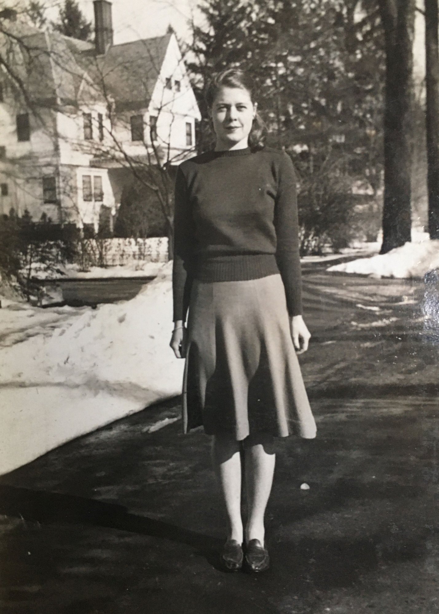
MIT held classes year-round during World War II, so Norwood arrived in Cambridge in the summer of 1944, shortly after her high school graduation. The alumnus who’d interviewed her admitted he’d never interviewed a woman before (and told her she was less frumpy than the MIT women he’d known), but she wasn’t deterred when she found herself one of only around a dozen women in her class. MIT then had no dorms for women, so she rented a room in a Central Square apartment, walking to campus on nice days or taking the Mass. Ave. streetcar for a nickel in bad weather. Women were allowed to dine in the dormitory dining halls only as guests of male students; she often subsisted on toast and sliced tomatoes.
As the eldest daughter of an Army officer, Norwood was practiced at putting down roots wherever she found herself. She’d lived in Panama (where she’d watched the world’s largest boat make its way through the canal), in Oklahoma (where she’d joined a mounted Girl Scout troop), and in Bermuda. When military families got sent back to the mainland after Pearl Harbor, she’d attended five different high schools. At MIT, she quickly found her way to the Institute’s one dedicated female space, the Cheney Room—a suite including a kitchen, an office with a few desks, three beds, a shower, lockers for books, and “a big, lovely living room” with a grand piano. There, the small contingent of MIT women would gather to talk, study, and cook.
Although shocked to learn that nearly all her classmates had also been salutatorians or valedictorians, she was so well prepared that she took five courses instead of the usual four for several semesters. “I didn’t work my first year or so,” she says. Listening in class and doing the p-sets was sufficient, leaving plenty of time to explore Boston, wander its parks, and socialize.
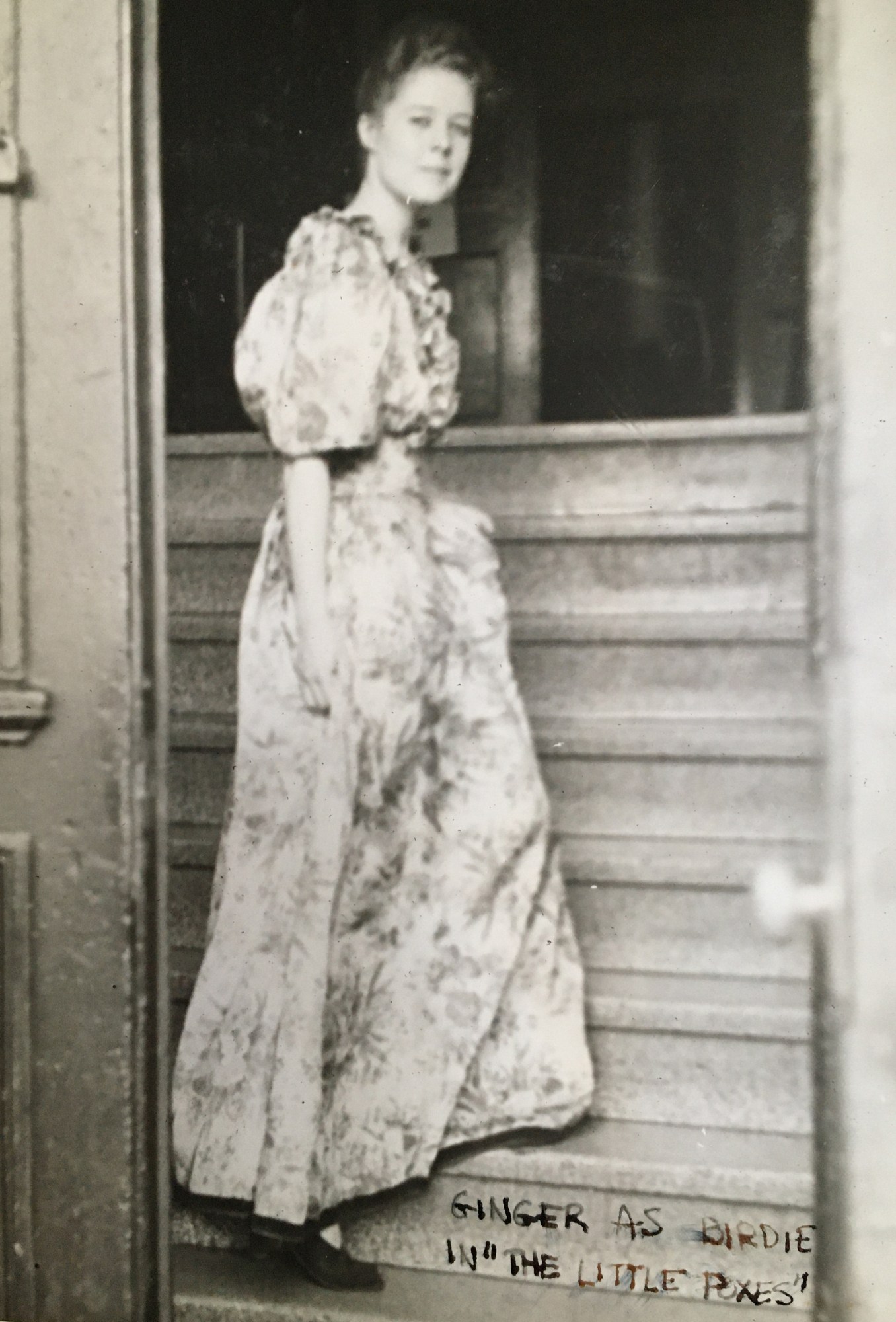
“Since women were in such short supply, we could have a date every night if we wanted to,” she says, adding that one classmate “prided himself on having dated practically every woman in our class.” Being in what she calls “a sea of men” made her a shoo-in for roles in Dramashop productions (The Importance of Being Earnest and The Little Foxes among them). But it could also make life awkward; a professor who routinely scanned the classroom as he lectured would inevitably find his gaze settling on Norwood’s legs, shake himself, and restart his sweep of the room. And the three times a week that women were allowed to swim in MIT’s pool, men reluctantly donned bathing suits.
(Strangely, women at the Institute could somehow be as invisible as they were conspicuous. Years later, Norwood would run into alumni from her era who claimed they’d had no idea that MIT was coed.)
In her fourth term, Norwood finally found herself in a class that didn’t come easily. After struggling in physics and earning an average grade, she took the winter of 1946 off and taught herself the material by working through every problem in the textbook. She returned to MIT that spring, sharing a two-bedroom apartment in Bexley Hall with three other women, and took all graduate classes her last four semesters.
“I think I got a very good education in math and physics,” she says. She even got a chance to study with the renowned mathematician Dirk Struik, who didn’t normally teach undergraduates but, pressed into service for freshman physics during the war, would open the textbook and say, “Now what would the physics department want me to teach you today?” She took a graduate-level reading course in analytic geometry with him as well. “We thought we were in the best school in the world,” she says. And having an MIT degree—a fact that would surprise many colleagues—gave her confidence as she carved out a career in which math and physics were essential and women a rarity.
A maddening job search
The day after finishing her bachelor’s degree in mathematics, she married Larry Norwood, her third-semester calculus instructor and president of MIT’s math club, who was by then a grad student at Yale. It quickly became apparent that few potential employers would hire a female mathematician. At an interview at Sikorsky Aircraft, her request for a P1 salary—that afforded to the lowest professional rank in the civil service—was met with incredulity; the company had never paid a woman that much. Asked to promise not to get pregnant if hired at a food lab, she withdrew her application. Over three interviews at Remington, she outlined her vision for how a staff mathematician could improve the gun company’s operations. The hiring manager called to say that she’d convinced them it was a brilliant idea—and that they were going to look for a man to fill the position. Norwood was out when the call came in; the manager conveyed his thanks to her husband.

Desperate for some income to supplement her husband’s meager instructor’s wages, she sold blouses at a small New Haven department store—a job she’s sure she would not have gotten had she disclosed her MIT degree. Norwood remained stoic during extensive training in how to read a sales tax chart and challenged herself by auditing advanced math classes at Yale. And she endured selling frilly blouses (she preferred tailored clothes) until she finally got hired to teach business arithmetic at the Junior College of Commerce in New Haven.
Teaching math was a step in the right direction, but Norwood’s true career didn’t begin until a family friend invited her to visit the US Army Signal Corps Laboratories in New Jersey. When she and her husband were both offered jobs at its Evans Signal Lab in 1948, they jumped at the chance.
Tracking the wind
Assigned to the lab’s weather radar group just as radar was beginning to be used in meteorology, Norwood was asked to develop a radar reflector for weather balloons so they could be used to track winds at high altitude.
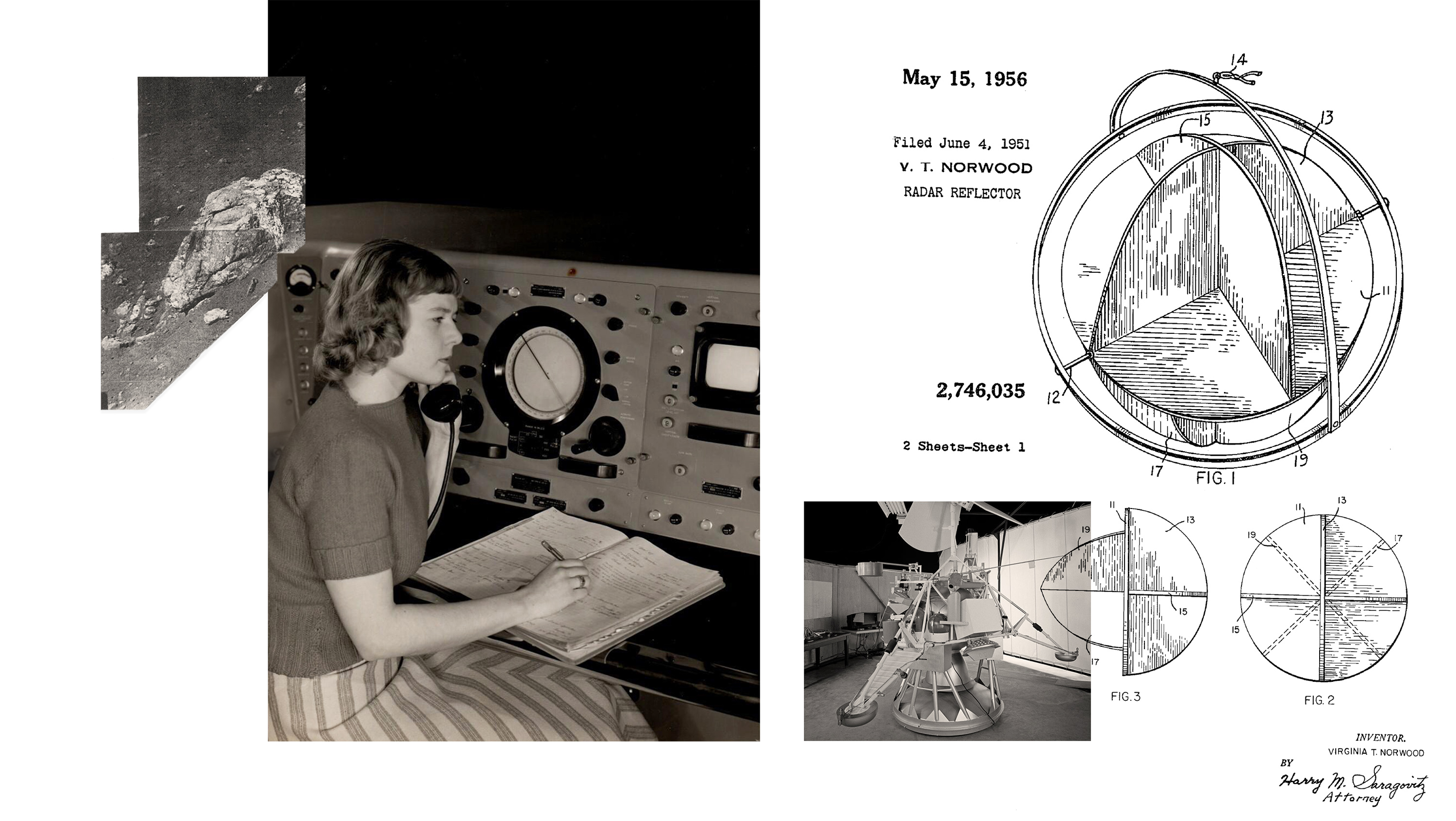
“You sit and think about a problem,” she says, “and the solutions come to you after a while.” She landed on a design featuring discs (painted silver or made of metallic cloth) that intersected to create a series of reflective corners. The device, suspended on fishing swivels, would spin in the wind, producing a characteristic pulsating signal that could be tracked by radar. At last, meteorologists could accurately calculate wind velocity above 100,000 feet—roughly the height at which weather balloons burst. And this feat made long-term weather prediction possible for the first time. The device, which Norwood designed at age 22, was later patented.
Not long after she finished that project, lab members were discussing how to design telemetry towers for a missile testing range being developed at Cape Canaveral in Florida. “Somebody in the lab said, ‘Oh, let’s make them 1,000 feet tall.’ I was in the meeting and I said, “Do you know how tall the Eiffel Tower is?’” she recalls, amazed that her colleague was arbitrarily proposing towers nearly that height. One was meant to be built several hundred miles offshore, and Norwood realized that such a tower would be expensive to construct—and vulnerable to hurricanes.
To figure out exactly how tall the towers had to be, Norwood needed historical wind and temperature data. Several male colleagues were sent to Washington, DC, to get it, but they returned empty-handed. Norwood went herself and met with the formidable Frances Whedon, the US Signal Corps meteorologist who had refused to release her data. It turned out that Whedon had earned an MIT degree in meteorology in 1924. “She had been absolutely brusque with the men, but she took a shine to me,” says Norwood, who quickly got clearance to visit the archives containing Whedon’s penciled weather logs.
Norwood calculated that the towers needed to be only about 100 feet high. “They were hell bent on making 1,000-foot ones,” she says. “I went about proving through data that they could get along with them being shorter.” The towers were built at Norwood’s recommended height and used for missile tests in the 1950s and ’60s.
Learning a trade
Despite having earned a patent for one of her first assignments in weather radar, Norwood says she did more important work when she moved into the antenna group. The Signal Corps was interested in exploring different types of radar antennas, building on microwave radar technology developed at MIT’s Radiation Lab that had proved useful during World War II. By the early 1950s, the antenna group at Evans was among the few places pioneering the development of transmitters and antennas that used microwaves at increasingly short wavelengths, and figuring out how such technology could be applied. In that group, Norwood would earn a second patent for a novel—and long classified—tracking antenna. (Its feed didn’t have to rotate to track an incoming signal; instead it used polarization to identify the signal’s angle and direction.) And being part of the antenna group, it turned out, would prove invaluable as the field of microwave antennas burgeoned. As Norwood says, “I learned a trade.”
In 1953 she and her husband went to California, and she quickly got a job at Sylvania Electronic Defense Labs and set up its antenna test range, sourcing equipment from Bill Hewlett, SM ’36, and Dave Packard. About a year later, she and her husband and baby daughter moved to Los Angeles, where she joined the antenna lab at Hughes Aircraft, becoming the only woman among the roughly 2,700 men in the company’s R&D labs. She went to work for Lester Van Atta, who’d done pioneering radar research at the MIT Rad Lab in the early days of the war and ran “one of the best antenna outfits in the country,” says Norwood. “We built some very interesting antennas—some of which I can tell you about.”
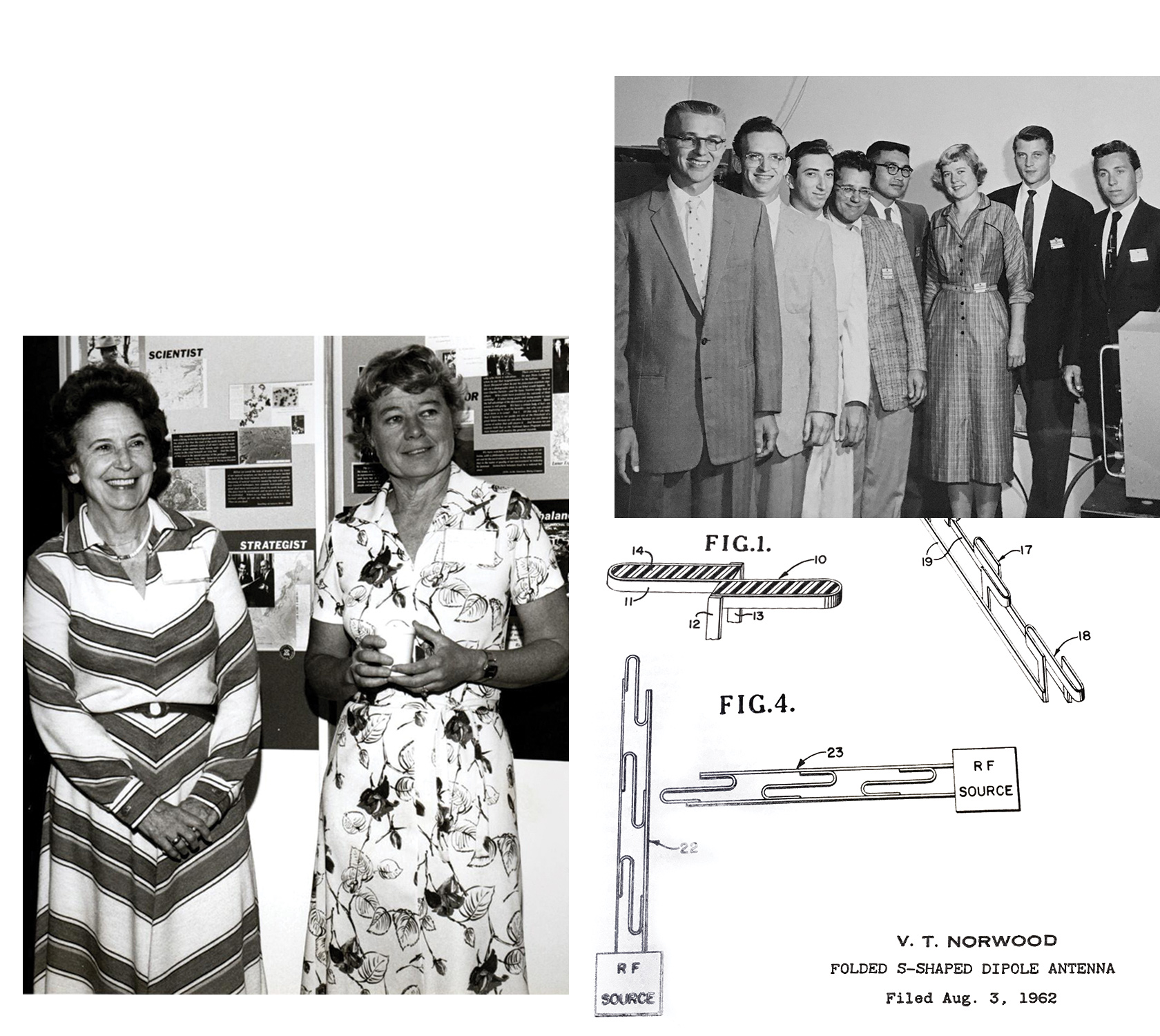
In one of those now declassified projects, she designed an antenna for a system that identifies friends and foes. The IFF, as it’s known, has to pick up a distinctive signal transmitted by all US aircraft to prevent warplanes from shooting down one of their own. But she had to make sure the IFF antenna wouldn’t block another, larger antenna mounted behind it—a long-distance surveillance antenna scanning the horizon for enemy aircraft or missiles. Hughes now holds a patent for the folded S-shaped dipole antenna she came up with. “I guess it worked,” she says, only half joking. Friend-or-foe identification technology is so vital that development of its components was partitioned to make sure no one person would know the whole system.
Managing microwaves (and men)
In 1957, Norwood was tapped to lead the microwave group for the company’s missile lab. But not everyone was pleased to see a woman rising in the ranks at Hughes. As the first woman to join the technical staff, she’d initially been refused a parking permit for its lot since “only men parked there.” A colleague once told her that women—especially those with children—should not be working in the labs. (Norwood would take off just three days when the second of her three children was born, in 1959.) Now that she was in charge of microwave antennas and circuitry for missiles, one man quit, saying he didn’t want to work for a woman—or for a company “stupid enough” to put a woman in that role. (He returned to Hughes several years later and asked to work in Norwood’s group. She said no.)
In the missile lab, she and her group developed antennas to help the Falcon missiles home in on their targets. Norwood also designed the transmitter and microwave receiver for the world’s first communications satellite. In 1963, Syncom 2—short for synchronous communication—made possible the first two-way satellite call between heads of state when President Kennedy in Washington called Prime Minister Abubakar Tafawa Balewa of Nigeria aboard a US ship in Lagos Harbor. A year later, Syncom 3 was used to broadcast the 1964 Tokyo Olympics to the US.
Sending data from the moon
As NASA was gearing up to send the first man to the moon, it needed a scouting device that could report back on the suitability of a proposed landing site. “They didn’t want the man to fall down a crack in the moon,” Norwood recalls.
Previous reconnaissance devices had sent back images of their approach to the moon, but every single one had crashed upon landing, rendering them useless for examining the surface. “There was a big argument as to what was below the top layer of moon, which was all we had seen,” says Norwood. “People had the most outlandish ideas about what might be down there.” The theory that it was made of green cheese was “probably one of the more logical ones,” she says, laughing; some even thought the moon might be a hollow shell. NASA didn’t buy into those theories, but it needed a craft that would survive the landing so it could take images on the surface, scoop up a sample of soil, and analyze it.
As another group at Hughes tackled the problem of achieving a soft landing, the challenge of making sure that the lander, known as Surveyor, could receive commands and send images and data back to Earth fell to Norwood and her microwave group. Having devised ways to tuck tiny, lightweight transmitters and antennas between the delicate fins of missiles, “we were accustomed to being very constricted as to space and weight,” she says. “So we were the obvious ones to give that job to.”
In fact, she herself designed the transmitter that sent all Surveyor’s data back to Earth. She also oversaw the design of the system’s antenna, which she describes as “a complete novelty at the time.” A space-efficient planar array instead of the typical curved parabola, it folded compactly for flight and then opened on the moon. It was attached to a solar panel that harvested the energy to run all the lunar lander systems.
Surveyor launched on May 31, 1966, and Norwood, who by then had moved to what would become the space systems division, recalls being at Hughes and watching screens with a subfeed showing the command center at the Jet Propulsion Lab (JPL) when it reached the moon on June 2. A big yell went up when the JPL team confirmed—thanks to the communications equipment Norwood and her team had designed—that Surveyor had landed intact. When the signals that Surveyor sent back over Norwood’s transmitter were decoded into data and images, NASA was able to confirm that the site would be hard and level enough for a manned craft to land.
Getting ready for Earth’s close-up
Within months of Surveyor’s launch, Norwood had begun thinking about a project that had nothing to do with weaponry or space exploration—one that wouldn’t involve handling classified data. “It’s no fun to go into a so-called black chamber where you had to put your work in a safe every time you walked out of the room,” she says.
She knew NASA and the US Geological Survey were talking about building a satellite to observe Earth and monitor its resources. “With a satellite, you can get up to mountaintops and all the places the geologists would like to know about and didn’t have data for,” she says. NASA was planning to equip the satellite with return beam vidicon (RBV) cameras—television cameras similar to those used for the moon missions. The idea was to capture freeze-frame analog images of Earth using three RBVs with different filters to record the green, red, and near-infrared sections of the electromagnetic spectrum.
But Norwood thought that a multispectral scanner (MSS) could be more useful. Such a scanner would be able to capture both visible and invisible light and sort it into more than just three spectral bands, creating a treasure trove of information. One band, for example, would allow the study of water quality; another would reveal the vigor of crops; a third could show chlorophyll absorption; others could be used to determine soil moisture or the density of snowpack.
In fact, agronomists had already been sending spectrometers up in planes to collect such data on a sampling of fields. But a satellite scanner would gather images on a continuous basis, letting agronomists monitor precisely how many acres of specific crops were growing, potentially anywhere in the world. Arborists could spot early signs of disease and blight in trees and take action before they spread. Those managing dams and watersheds would have regular feeds of data on soil moisture and flooding. Census managers could track how quickly wild and agricultural land became urbanized, and economists could gauge the relative economic prosperity of neighborhoods by comparing the extent of their green space.
What’s more, the scanner would be digital. Its detectors would capture individual pixels, each representing an area roughly the size of a football field. Those pixels would be strung together to form lines of data that could then be compiled to form images line by line. Digital images could be analyzed with computers, and data from different spectral bands could be compared—offering far more precision than visual analysis of analog images. And that ability to analyze spectral data made it possible to identify the material being imaged. For example, fields of wheat and corn would look the same from space but could be distinguished by their unique spectral signatures. The possible uses of a multispectral scanner seemed endless.
Norwood pitched her idea to the top brass at Hughes and was given $100,000 to develop a prototype to show NASA.
She met with potential users to find out what sorts of data they needed, and zeroed in on the six spectral bands that would be most useful. Then she set about designing a system that could efficiently image those bands and relay the data back to Earth.
NASA had determined that the satellite would orbit around the poles at a height of 500 nautical miles. As it traveled from north to south while the planet rotated beneath it, Norwood’s scanner would need to record the light reflected off a diagonal strip of Earth 100 nautical miles wide. With each orbit, Earth would have rotated, and a new 100-nautical-mile strip would be lined up for scanning. Over the course of 18 days, the entire planet could be scanned—and then the whole process would repeat. The scanner would always be in the same relation to the sun at each latitude, so the lighting would be consistent when the strips were pieced together.
Norwood realized from the outset that the scanner couldn’t withstand the wear and tear of moving back and forth to capture the width of the strip. So she had the idea of using a mirror that would pivot back and forth to reflect the light into it. The incoming light would be filtered into the six spectral bands, and then directed to separate detectors for each band. To keep up with the speed of orbit, the scanner would need to capture six lines at a time, so each spectral band needed six sensors. The sensor data would be digitized and sent to receiving stations on the ground, where it could be decoded into images for each spectral band or combined as needed to create composite images.
Norwood was adamant that the data stream should be digital. NASA had serious reservations, doubting that the six-bit MSS data could produce high-quality images. But she knew that a continuous analog signal would be difficult to process accurately. Going digital would make it possible to calibrate the photon levels from each sensor very precisely. “And you do want it to be accurate,” she says: otherwise “you get a striped mess” when the data is reconstructed into images. So she worked with a microwave colleague at Hughes to figure out how best to digitize the sensor data. As the MSS imaged the US, data would be relayed to US ground stations in real time; images of the rest of the world would be stored on videotape until they could be beamed down to the US stations. (Later, ground stations would be established around the world.)
Ultimately, NASA officials would later tell her, the MSS data would be the first data transmitted digitally from space. And it would set the standard for future quantitative remote sensing.
To create the pivoting mirror setup, Norwood called on Web Howe, a “resident inventor” at Hughes. Howe came back with an ingenious design taking advantage of the low gravity in space; the pivoting mirror would rock back and forth as its edges banged into bumpers on either side. With no external forces on the mirror—in space, it would be weightless and encounter no air resistance—inertia would keep the mirror banging back and forth between the bumpers at a steady rate of more than 13 times per second. Each time it rocked one way, the sensors would capture from the reflected light another six lines of data for each spectral band, keeping pace with the satellite as it traveled south. And each time the mirror rocked back, it captured the light from a calibration lamp.
Norwood understood the brilliance of Howe’s design, but she had to convince a lot of naysayers that it would work. “Hughes people were primarily electronics people,” she says. “And they shuddered at the idea of this mechanical mirror.”
If some at Hughes were skeptical, many researchers at the US Geological Survey and NASA were convinced that the MSS couldn’t possibly yield useful data. They were all familiar with the vidicon television cameras used for Surveyor and early Apollo missions and accustomed to the full-frame analog images they captured. They balked at the idea of launching an untested mechanical device that scanned line by line—and relied on a banging mirror, of all things. The debate over which system should prevail dragged on for more than a year. “Mapmakers like myself were very suspicious of the multispectral scanner, which we could not believe would have geometric integrity,” USGS cartographer Alden Colvocoresses would later confess.
“The only ones that were really skeptical that I encountered really didn’t understand how it worked. They knew that there was a banging mirror,” Norwood says. “They just felt that was too crude.” Fortunately, she adds, she only had to convince her upper management—and they were all pretty smart people.
When NASA asked for a reduction in the scanner’s size, weight, and power requirements, Norwood and her team pared down the design from a six-band scanner to one with four bands. The prototype, which measured 89 by 59 by 40 centimeters, had a 9-by-13-inch oval mirror (made of beryllium so it could withstand the banging and wouldn’t warp or vibrate) and the controversial bumpers that made the engineers cringe. It weighed just 48 kilograms, or about 105 pounds.
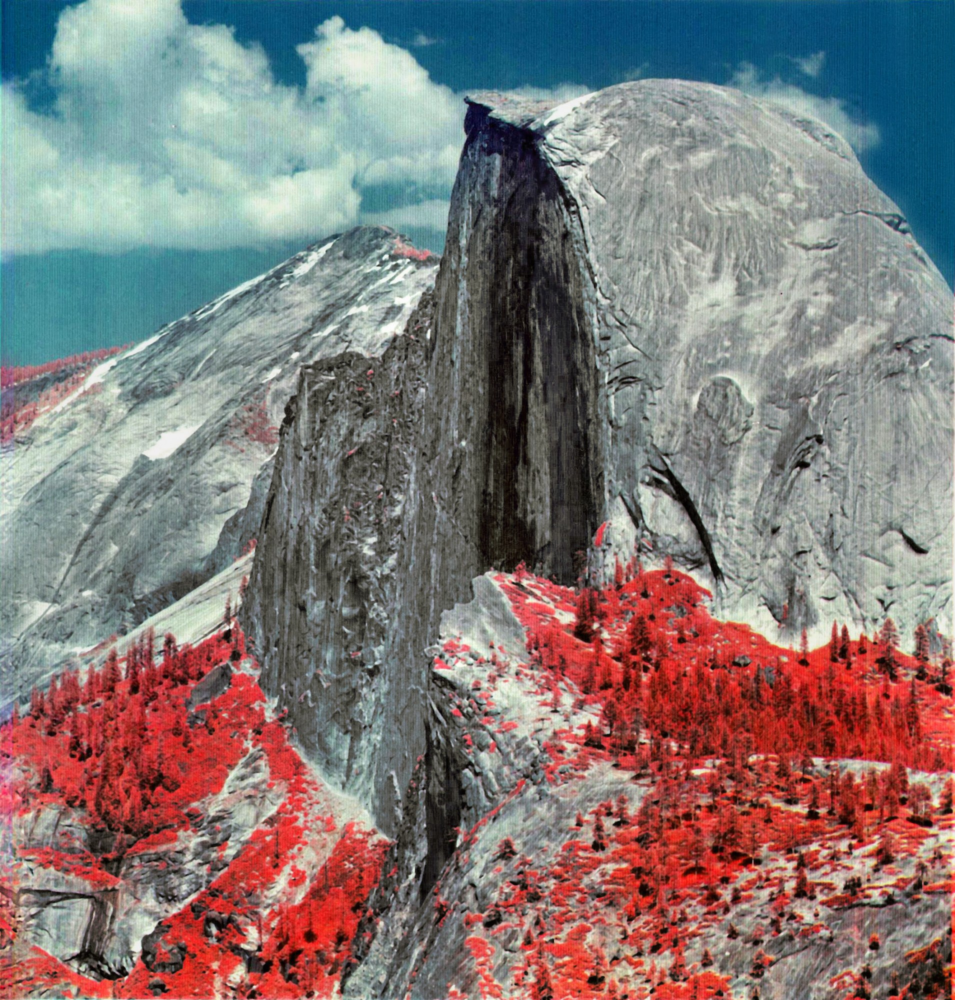
Norwood had researchers load a breadboard version of the scanner onto the back of a truck. It amounted to “just a bunch of boxes,” she says. “We could use all the weight we wanted.” They drove around California, scanning Half Dome, Yosemite Valley, and San Francisco’s skyline. Having labored so long over the specs, Norwood wasn’t surprised by the high quality of the test images.
NASA ended the RBV-versus-MSS debate by deciding to include both on the satellite. There wasn’t time or money to turn Norwood’s prototype into a final, refined product, so the prototype itself was used. As her daughter, Naomi Norwood, says, “Nobody expected it to work except my mom and some other people who worked on it.” Most people assumed that the vidicons would be valuable; the scanner was considered experimental. “The average person didn’t realize what a distorted picture a TV camera puts out,” Norwood says. “We wanted scientific precision.”
A stunning debut
On July 23, 1972, Norwood sat with her husband and younger son in the bleachers at California’s Vandenberg Air Force Base as the Earth Resources Technology Satellite (which would later be renamed Landsat 1) launched with her MSS prototype aboard. “I had never seen a rocket launch in person,” she says. “So that was exciting.”
Two days later, researchers convened at NASA’s Goddard Space Flight Center to see the first MSS data translated into images. When scenes of clouds gave way to wavy images of land, a technician complained about the “terrible” moiré pattern. But soon they realized that the image was of the Ouachita Mountains in Oklahoma, the wavy lines accurately representing the folds of the range. One geologist got tears in his eyes. “I was so wrong about this,” admitted another, who’d been an MSS skeptic. “I’m not going to eat crow. Not big enough. I’m going to eat raven.”
Eleven days after the launch, a massive power surge on the satellite knocked out one of the two videotape recorders storing RBV images and MSS data gathered while the satellite was beyond reach of US ground stations. Three days later, a second power surge linked to the RBVs rocked the satellite, causing it to point away from Earth, threatening the mission. The satellite righted itself after the RBVs were turned off, and the engineers quietly decided to leave them off for good. The data Norwood’s MSS was sending back to Earth—digitally—was yielding stunningly clear and sharp images.
“I’d go to meetings and people were just jumping up and down because they had discovered another use for the data,” she says. And not just scientists: for years, anyone in the world could purchase a Landsat image of any place on Earth for just $1.25. Image access and prices shifted over the decades—but in 2009, all Landsat images became available for free.
Norwood was involved in the next four versions of Landsat, which launched in 1975, 1978, 1982, and 1984; Landsats 4 and 5 flew not only versions of her four-band MSS but also her original design. (Called the “thematic mapper,” it scanned six spectral bands as she’d initially envisioned, plus one more.) In 1977 she moved on to the electro-optics systems group at Hughes, where she served as a senior scientist and then a laboratory engineer, working on the design of large active antennas for space and other highly classified government projects.
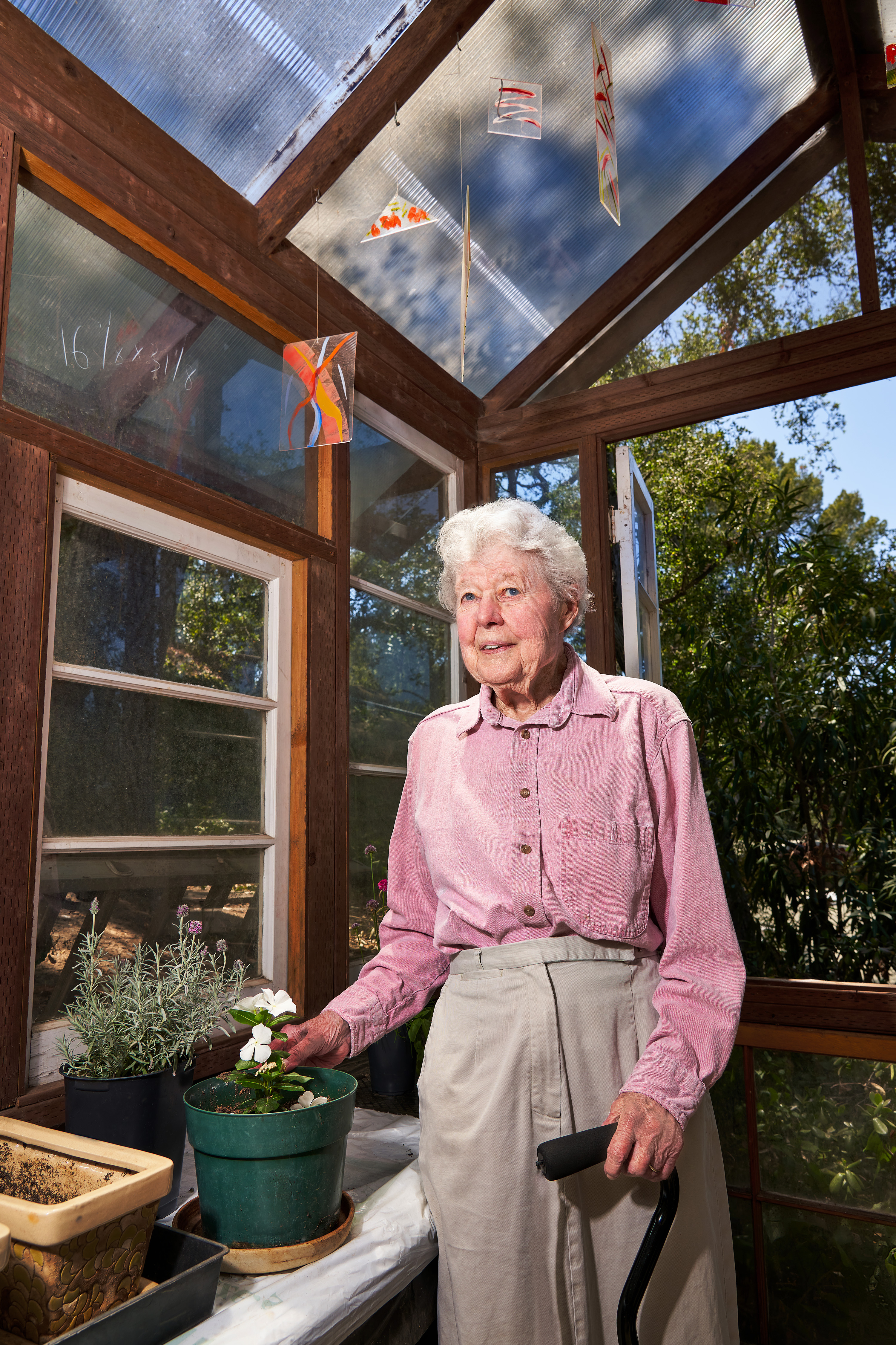
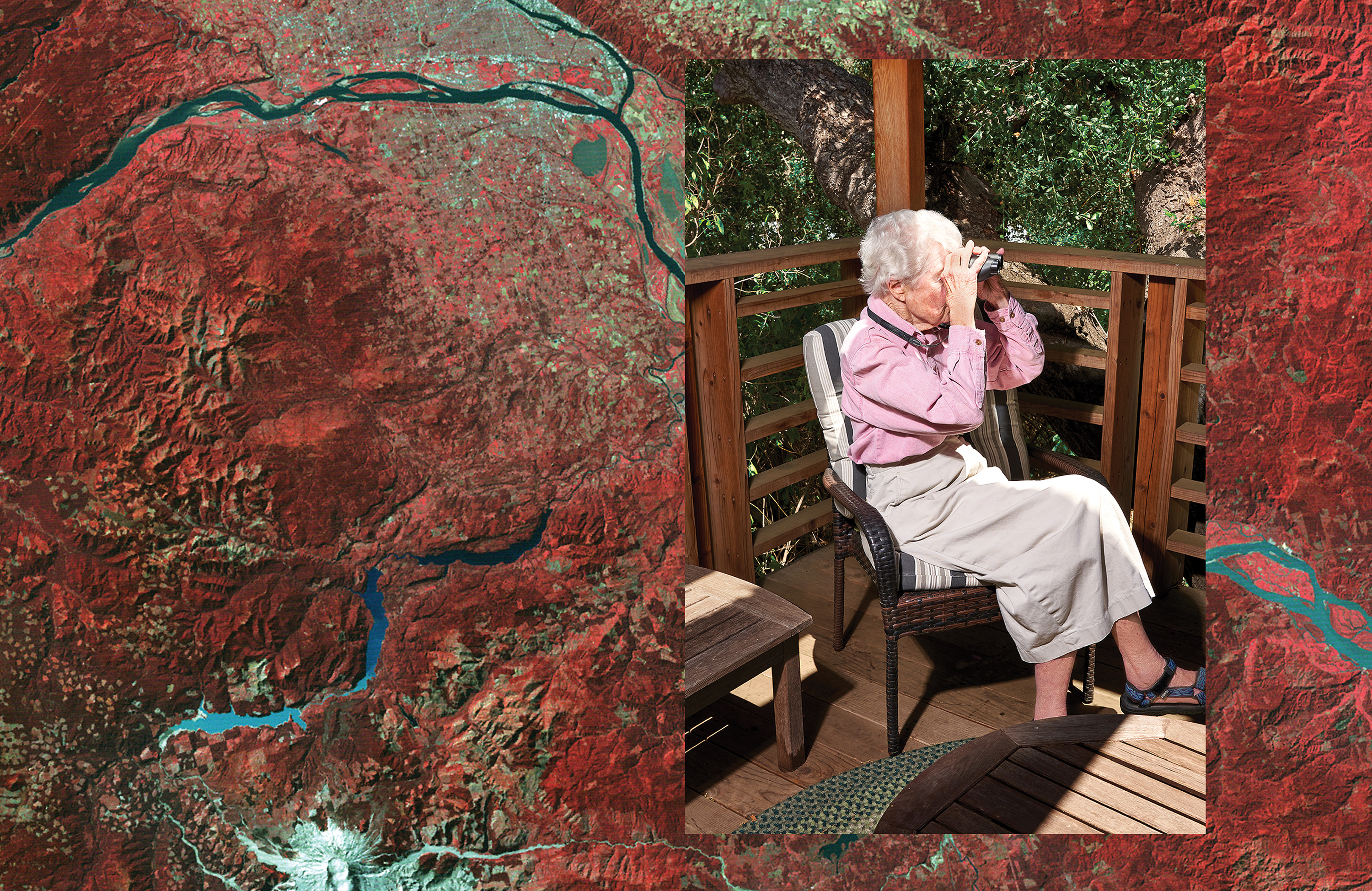
Upon retiring in 1989, Norwood began collecting and restoring antique clocks, often machining her own parts to do the job. She continues to indulge a lifelong enthusiasm for sports cars (although her license lapsed during the pandemic, she says her silvery-blue six-speed Mazda Miata handles better than her previous Jaguars, MGs, and Alfas), and she has become a keen birdwatcher, emailing her daughter each morning with the daily tally of species in her backyard (she once counted 18).
Meanwhile, the Landsat scanning program that she brought to life has been keeping an eye on the world since 1972. The scanners have continued to evolve over the years, and Landsat 8, which launched in 2013, features the “push-broom” design she’d originally wanted to build. Its detectors are arranged across the swath being imaged, sampling every line as the satellite moves in its orbit, with no mirror required. “That would’ve been my first choice, that design,” she says. “In fact, I configured one. But we didn’t have the detectors—that takes thousands of detectors with no gaps.” Landsat 9 is scheduled to launch in September 2021.
Landsat’s impact has been far greater than anyone could have imagined in 1972. Beyond playing a key role in ushering in the era of digital imaging, its scanners have chronicled the near disappearance of the Aral Sea between Kazakhstan and Uzbekistan, a lake that was the world’s fourth largest before two of its feeder rivers were diverted for agricultural use. Landsat’s images of the 1988 Yellowstone Park fires greatly advanced our understanding of fire science. It has also documented such things as the retreat of glaciers, the stunning growth of Beijing, and the eruption of Mount St. Helens in 1980.
Norwood, who earned a lifetime achievement award from the American Society for Photogrammetry and Remote Sensing this year, is especially pleased that Landsat was able to image parts of the world that had never been captured before. But her favorite Landsat image has more personal significance. “I like the one that has my house,” she says. Captured by the original Landsat on one of its first passes over LA in 1972, it now hangs in a hallway in her home. It features a crisp image of LA and a patch of the Pacific, her own modest house hidden among the contours of the Santa Monica Mountains.
Keep Reading
Most Popular
Large language models can do jaw-dropping things. But nobody knows exactly why.
And that's a problem. Figuring it out is one of the biggest scientific puzzles of our time and a crucial step towards controlling more powerful future models.
How scientists traced a mysterious covid case back to six toilets
When wastewater surveillance turns into a hunt for a single infected individual, the ethics get tricky.
The problem with plug-in hybrids? Their drivers.
Plug-in hybrids are often sold as a transition to EVs, but new data from Europe shows we’re still underestimating the emissions they produce.
Google DeepMind’s new generative model makes Super Mario–like games from scratch
Genie learns how to control games by watching hours and hours of video. It could help train next-gen robots too.
Stay connected
Get the latest updates from
MIT Technology Review
Discover special offers, top stories, upcoming events, and more.