Street Sense
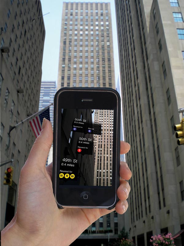
An iPHONE 3GS application from Acrossair offers a new way to navigate the urban jungle of several major cities. The system uses the iPhone display as a viewfinder for the phone’s built-in camera. Pointing toward the ground will call up arrows indicating the locations of all the city’s subway or light-rail lines. Holding the iPhone horizontally will overlay labels on the scene identifying the locations of the nearest stations, along with the distance to each one and the lines it serves. Acrossair has released versions for New York, Chicago, San Francisco, Washington, DC, Barcelona, London, Madrid, Paris, and Tokyo.
Product: Nearest Subway
Cost: $1.99 Availability: Now
Source: www.acrossair.com
Companies: Acrossair
Keep Reading
Most Popular
Large language models can do jaw-dropping things. But nobody knows exactly why.
And that's a problem. Figuring it out is one of the biggest scientific puzzles of our time and a crucial step towards controlling more powerful future models.
How scientists traced a mysterious covid case back to six toilets
When wastewater surveillance turns into a hunt for a single infected individual, the ethics get tricky.
The problem with plug-in hybrids? Their drivers.
Plug-in hybrids are often sold as a transition to EVs, but new data from Europe shows we’re still underestimating the emissions they produce.
Google DeepMind’s new generative model makes Super Mario–like games from scratch
Genie learns how to control games by watching hours and hours of video. It could help train next-gen robots too.
Stay connected
Get the latest updates from
MIT Technology Review
Discover special offers, top stories, upcoming events, and more.